

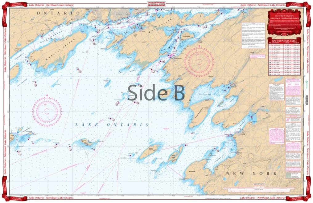
Standard Navigation, 76 Lake Ontario - N.E Lake Ontario
Product details
| Management number | 228134013 | Release Date | 2026/05/31 | List Price | $15.60 | Model Number | 228134013 | ||
|---|---|---|---|---|---|---|---|---|---|
| Category | |||||||||
Entire lake coverage from Kingston to Hamilton on one side, with 35 GPS Waypoints indexed and indicated on the chart. Provides detailed coverage of the northeast section of the lake from Stony Point west to False Ducks Islands and north to Kingston and east to Clayton. Covers the Cape Vincent Area and the popular Sacketts Harbor and Henderson Harbor areas. A total of 16 GPS Waypoints are printed directly on the chart. Information from 2 NOAA Charts 14802 and 14800. WGS84/World Mercator Datum. 25" x 38"
- Two Sided
- Foldable
- Tear Resistant Synthetic Paper (Hop-Syn) 5 PP Tree Friendly
| ASIN | B001441GM2 |
|---|---|
| Material | Polypropylene |
| Brand Name | Waterproof Charts |
| Part Number | 76 |
| Manufacturer | Waterproof Charts |
Bestseller ranking
Charts & Maps


Correction of product information
If you notice any omissions or errors in the product information on this page, please use the correction request form below.
Correction Request Form